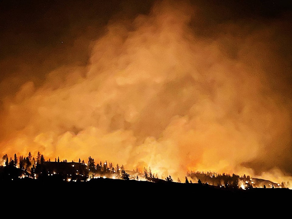
There are 85 active wildfires within the Kamloops Fire Centre, as of Friday, Aug. 6.
Wildfires of Note
There are still 16 wildfires of note within the Kamloops Fire Centre.
Sparks Lake
The Sparks Lake wildfire is estimated to be 77,101 hectares in size, according to the BC Wildfire Service, and is still classified as out of control.
The fire has not seen any significant growth over the last few days, says BCWS. It is currently burning unburned fuel between the fire and guards in the northeast and northwest. It was also noted that the Sparks Lake wildfire has merged with the Young Lake wildfire on the south end. Crews are now working together to ensure machine guards are built in the northeast.
BC Hydro crews are working around the clock to restore infrastructure in burnt areas. When the restorations are complete, BCWS will then reassess current evacuation orders.
Evacuation orders for the Skeetchestn Indian Band were lifted and residents returned home Thursday, according to a video update on the BCWS Facebook page.
“It was fantastic to see some of those residents come home,” said Benson Todd, incident commander from Western Australia.
The Sparks Lake perimeter map has been updated and can be viewed here.
There are 94 firefighters, 9 helicopters and 27 pieces of heavy equipment on the site of the wildfire. The cause is believed to be by human, but is still under investigation.
Momich Lake
The Momich Lake wildfire is now estimated to be 6,436 hectares in size. The increase in size is due to more accurate mapping as the area was more visible to air and land crews. The updated map can be viewed here.The cause of the fire is under investigation and the fire is classified as out of control.
Increased fire behaviour was seen on the northeast side of the fire along the hillside on Aug. 5, and progress has been made on the south and western sides.
The north, south and west Humamilt Lake recreation sites are currently closed.
The BC Wildfire Service is monitoring the fire with 1 personnel and the support of industry, who have 69 personnel and 33 pieces of heavy equipment on site.
Tremont Creek
The Tremont Creek wildfire is an estimated 30,606 hectares in size and is still classified as out of control.
On Aug. 5, the fire expanded to the northeast out of the Tunkwa Provincial Park and to the south of Mt. Savona. It is currently held on the western side.
Evacuation orders were issued for properties south along Highway 1, Haywood Farmer Road and Tunkwa Lake Road to the Tunkwa Provincial Park. An expanded evacuation alert was also issued by the TNRD for east of Tunkwa Lake Road including areas of Tobiano and Six Mile Ranch.
The BCWS also notes they are looking at getting large air tankers to place retardant lines to protect critical structure on Mt. Savona and to not be alarmed to see the aircraft operating close by.
White Rock Lake
As of Friday morning, the White Rock Lake wildfire was estimated at 45,000 hectares and burning out of control.
It stretched from the most northern flank at 13 kilometres southeast of Pritchard to the most southeastern perimeter five kilometres from Westside Road.
The wildfire grew exponentially over the past 24-hours along the northeastern and eastern flanks, with minimal growth along the southeast flank.
Fire officials have expressed disappointment in those who choose not to leave the evacuation order areas and put first responders at risk.
The new evacuation order includes 608 properties along Westside Road from 8525 Ewings Landing Road (south end) to 9995 Westside Road (north end), up to the Sugarloaf Forest Service Road turn off. Evacuess must leave the area travelling south on Westside Road as there is no access to the north.
Clearwater Fire Zone
A wildfire near the Raft River Forest Service Road (K22068) is about 582 hectares in size and deemed out of control. Another located northwest of Clearwater (K21361), also near Raft River, is an estimated 358 hectares in size, also out of control. Both are being monitored through the Kamloops Fire Centre and have one resource assigned. The causes are unknown.
There are seven wildfires in Wells Gray Park, the largest near Angus Horn Creek at 2,169 hectares. The fires in that area do not have resources assigned to them, according to the Kamloops Fire Centre, as they do not pose an immediate threat to people, property or critical infrastructure. However, crews in the air do continue to monitor the fires in the area as they travel to other sites and will action the fires if required.
newsroom@clearwatertimes.com
Like us on Facebook and follow us on Twitter