By Cam Fortems
While several areas of the province are seeing the lowest snowpack in recorded history, both the South and North Thompson watersheds are within the normal springtime range.
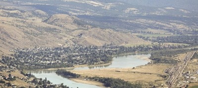
The most recent snowpack survey by B.C.’s river forecast centre found the South Thompson watershed at 81 per cent of normal and the North Thompson at 91 per cent.
That compares to 14 per cent on Vancouver Island and 12 per cent on the South Coast — the lowest recorded numbers for the end of April.
According to a graph produced by the City of Kamloops, the flow beneath Overlanders Bridge is considerably below last year’s level.
Dan Sutherland, the city’s emergency program manager, said the river system bumped up earlier this spring with the onset of warm weather, taking with it low- and medium-elevation snowpack.
“We saw the river rise four to six weeks early and go back down,” he said.
“We haven’t seen that in past.”
All that remains is alpine snowpack, the bulk of which will come down in the next month.
The river at Overlanders Bridge typically peaks in early June.
Sutherland said flooding can still occur in the valley if a number of weather-related events converge.
Those include a spate of hot weather and warm evenings, followed by hard rains in the North Thompson system.
Cam Fortens is a reporter for Kamloops This Week.